AUSTRALIA ABLAZE!

Continent-spanning fires visible from space
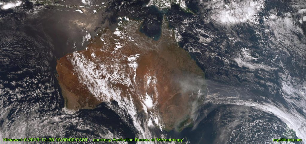
CONTINENT OF FIRE Seen from space, the dark grey plumes of smoke rising from the massive fires in eastern Australia form a grim contrast to the white clouds

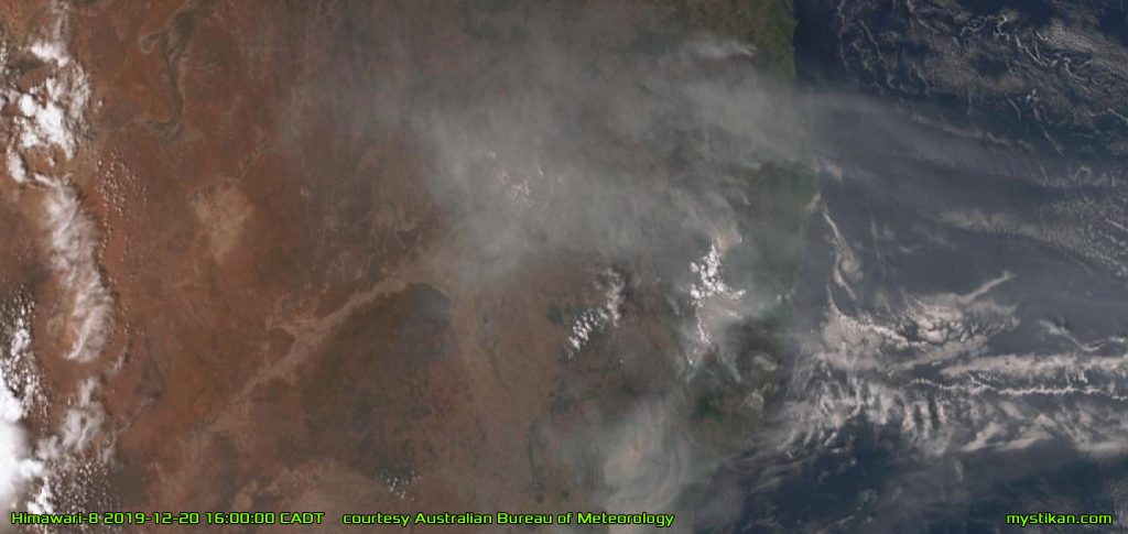
These maps, taken by the Himawari-8 weather satellite at 4PM Central Australian Daylight Time on 2019-12-20, reveal in stark detail the huge range and reach of the bushfires currently ravaging the nation. All along the eastern coast and the Great Dividing Range, the dull grey plumes of smoke from the bushfire fronts rise into the atmosphere to be blown eastwards over the Pacific by the jet stream. Along the Blue Mountains down through the Snowy Mountains and the Australian Alps as far south as Gippsland, a clearly visible and near-continuous wall of fire has cut off the eastern cities from the remainder of the country.
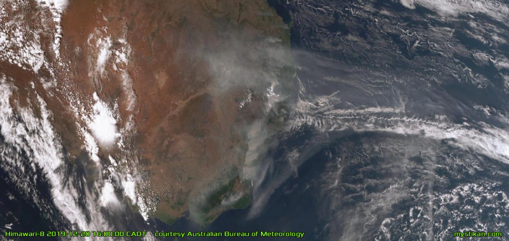
WALL OF FLAME This closer view reveals more detail and clarity in the lines of fire, and the reach of the smoke plumes being carried eastward by the jet stream
DEADLY BARRIER The wall of fire, over a thousand miles long, has effectively cut off the eastern cities of Sydney, Newcastle, Wollongong and Brisbane from the rest of the country. Road and rail travel through the inferno is impossible
FURTHER NORTH The fire front extends up into Queensland, passing Brisbane and reaching almost to Townsville

The fires have been burning unchecked for over two weeks, and efforts to contain them have so far proven fruitless. It highlights how we puny humans cannot hope to contain nature’s fury at such a scale. What makes the situation even worse is that we are coming from a year-long drought, with empty dams and dry rivers. There are reports of people giving up the water in their swimming pools to helicopters to fight the blazes, because all the dams have run dry due to the drought.
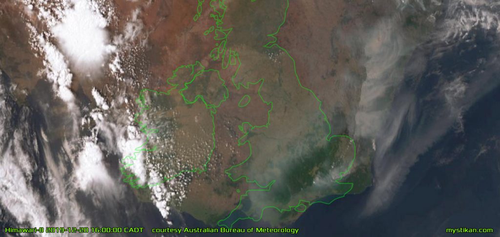
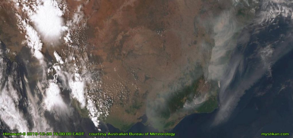
CLOSER TO HOME This zoomed in view of the Snowy Mountains and Gippsland bushfires, with the southern UK overlaid for scale, displays clearly delineated walls of fire barring passage. A lack of available water is hindering control efforts

Putting the fires in perspective

For those in other countries unable to grasp the magnitude of this catastrophe, there are maps with the British Isles, the United States and India overlaid on them. It can be clearly seen that if these fires were transplanted to the United Kingdom, there would be a wall of fire running from London through Edinburgh, as far as the Shetland Islands. The plume of smoke would be carried over Europe, darkening the skies as far east as Poland.
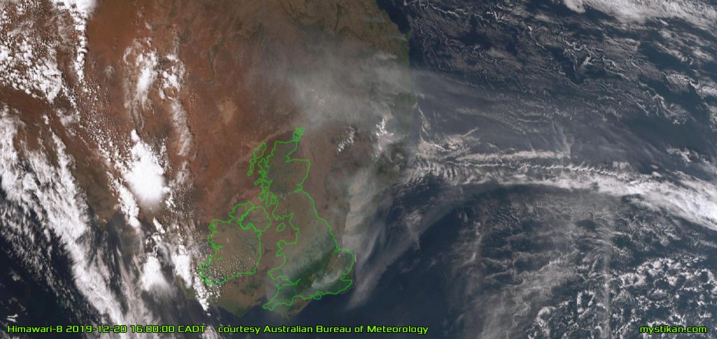
COMPARING BRITAIN If the fires were occurring in Britain, they would form a line of fire reaching from London through Edinburgh as far as the Shetland Islands; the smoke plume would darken the skies as far east as Poland

In the United States, if these fires were to occur there, the fire front would stretch from Los Angeles to Portland in a near-continuous wall of fire, with the smoke plume darkening the sky as far east as Wisconsin. Or, carried to the eastern seaboard, the fire front would run from Miami to Washington DC, and the smoke plume would reach Bermuda.
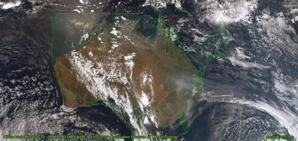
COMPARING THE UNITED STATES In this map, the lower 48 states of the USA is overlaid on Australia. This shows people living in the USA that if the fires were occurring there, they would form a wall of fire from Los Angeles to Portland, with the smoke plume reaching Wisconsin; or, if on the eastern seaboard, the wall of fire would stretch from Miami to Washington DC, and the smoke plume would reach Bermuda

If the fires were occurring in India, they would form a wall of fire from Chennai to Patna, and the smoke plume would cross the Bay of Bengal as far as Myanmar.
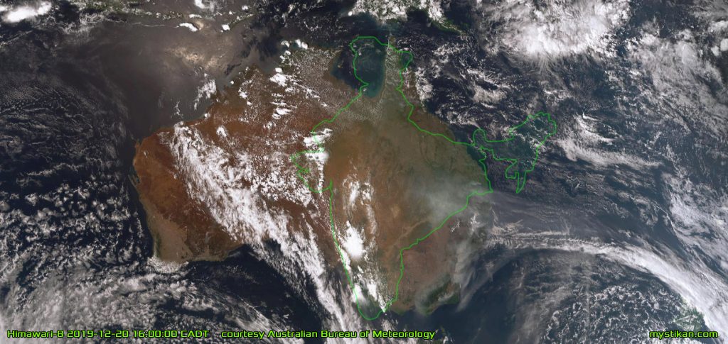
COMPARING INDIA Here the Republic of India is overlaid on Australia to show Indians the extent of these fires. If the fires were occurring in India, they would form a wall of fire from Chennai to Patna, and the smoke plume would cross the Bay of Bengal as far as Myanmar

Be aware, we are in danger

Our nation will survive this disaster, as it has many others. But for those of us still safe in our homes, it is my hope that these terrifying images will bring home to my fellow Australians just how far up shit creek we ALL are.